Join us as we take a closer look at weather systems in the second part of our discussion about weather and passage planning.
Weather Systems Pt 2/2
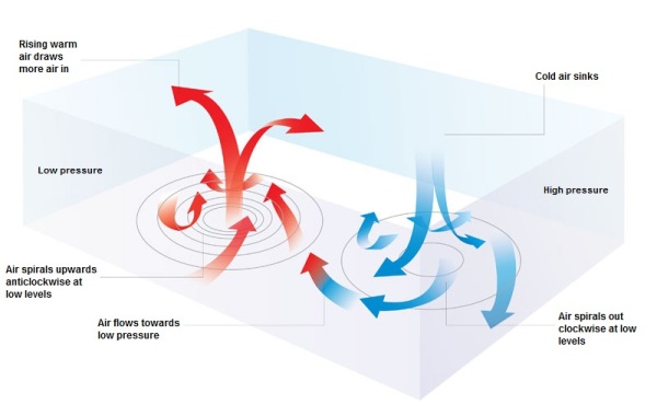
What causes air pressure to be high or low?
Credit: Met Office
Air pressure can be thought of as the weight of vertical air directly above us.
Low pressure air is formed when the surface of the planet is heated by the sun. The surface then heats the air above it. As the air is heated it rises and expands.
High pressure air is formed is formed with colder, denser air in the mid latitudes and polar regions.
Why do we get weather systems?
Weather systems are formed when bodies of air with different pressures meet each other, due to the spinning of the earth and the coriolis effect. Depending on where each body of air has come from will help determine the type of weather that can be predicted.
Credit: Met Office
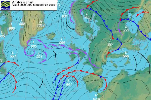
How do you tell an area of high pressure from low pressure on a synoptic chart?
When looking at a synoptic chart you notice lots of lines covering the chart – these are called isobars. The isobars indicate the pressure in millibars of a certain air mass. The low pressure areas will have a anti-clockwise rotation and the high pressure areas will have a clockwise rotation.
What are warm and cold fronts and what do they mean?
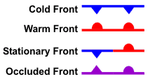
Weather Front Key
A warm front is formed with heated moist air coming out of the tropics.
A cold front is formed with colder heavier dryer air coming from the polar regions. The depressions forms when the two meet and the circulation of the planet makes them to spin due to the Coriolis effect.
An occluded front is formed when a cold front overtakes a warm front. This normally occurs around mature low pressure areas.
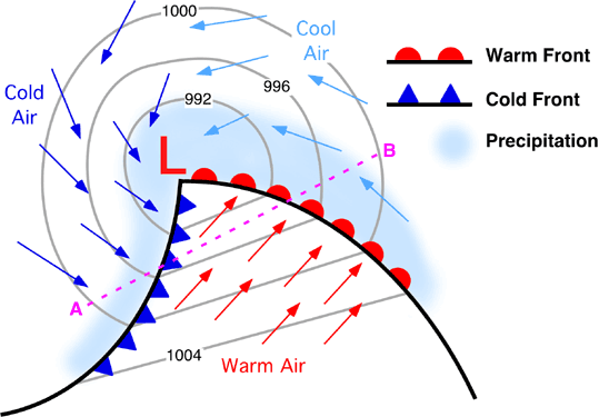
What weather can be expected during the different stages?
Credit: UK Weather Files
At the front of the depression, before the warm front, you would expect to see cirrus clouds (mares tails) and possibly a halo around the sun. The weather here is still generally nice, but be aware the rest of the depression is on its way.
At the warm front, the clouds will become a lot lower with heavy showers and higher wind.
Within the warm sector, there may be stratus clouds and the temperature will rise, although it will remain drizzly.
At the cold front, you should expect to find big towering cumulonimbus clouds and heavy rain. Once the cold front has passed there will be clearer skies and more sunshine, but it will be cooler.
 Weather Systems – Resources
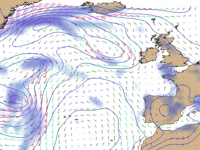
You can download GRIB files online from a program called U-GRIB. It is a free program and very simple to use – simply select the area you want and download it. U-GRIB offers a 7 day predicted forecast at intervals of 3 hours; making it easy to identify uncomfortable weather systems when passage planning. This program can be found at: http://www.grib.us/
Weather Systems – Further Education
 The RYA Day Skipper theory course is designed to build your understanding of the weather. Topics that are covered on the course include:
- Wind and barometric pressure
- Weather systems
- Warm, cold and occluded fronts
- Different types of cloud formation
- Understanding shipping forecasts
- Weather terminology.
One of the books we highly recommend is the RYA Weather Handbook. Written by a sailor for sailors, it explains the complexities of weather and is full of practical and useful advice on how to understand weather maps and improve your forecasting skills. The RYA Passage Planning book is another great resource.